


![]()
![]()
![]()
![]()
![]()
![]()
![]()
![]()
![]()
![]()
![]()
![]()
![]()
![]()
![]()
![]()
![]()
![]()
![]()
![]()
![]()
 |
. |
 Johnson
County is located in north central Texas on the southwestern
edge of the Dallas-Fort Worth area. Cleburne, the county
seat, is fifty-five miles southwest of downtown Dallas and
twenty-nine miles south of downtown Fort Worth. Johnson
County comprises 740 square miles with three geographical
areas. The western half is a part of the Grand Prairie,
where the predominant soil type is alkaline loam over
limestone. About one-third of the county is in the Eastern
Cross Timbers, with acid soils that are both loamy with clay
subsoil and sandy with loamy subsoils. The rest of the area
to the east is Blackland Prairie, with deep clayey, alkaline
soils. The Grand Prairie area supports grasses with cedar
and mesquite and is inhabited by white-tailed deer, coyotes,
rabbits, and squirrels. The Eastern Cross Timbers is a post
oak savannah with some acreage of improved Bermuda grass and
kleingrass. Cash crops of cotton, grain sorghum, and small
grains are grown in the Blackland areas. In addition,
pastures of kleingrass and Bermuda grass have been
established. The primary natural resources in the county are
sand and gravel. The topography is level to gently sloping
in the east and changes gradually to steep in some western
parts of the county. Elevation ranges between 600 feet and
1,000 feet above sea level. The primary water sources are
the Brazos and Nolan rivers. The Brazos flows along the
southwestern border of Johnson County, and the Nolan runs
north to south through the center of the county to join the
Brazos. Secondary streams include Chambers, Buffalo,
Mountain, Village, Mustang, Valley, and Walnut creeks. The
upper portion of the Lake Whitney, on the Brazos, and Lake
Pat Cleburne, on the Nolan, are the principal reservoirs.
The average annual precipitation is thirty-three inches, and
temperature averages range between a winter low of 35
degrees F and a summer high of 96 degrees. The grown season
averages 233 days.
Johnson
County is located in north central Texas on the southwestern
edge of the Dallas-Fort Worth area. Cleburne, the county
seat, is fifty-five miles southwest of downtown Dallas and
twenty-nine miles south of downtown Fort Worth. Johnson
County comprises 740 square miles with three geographical
areas. The western half is a part of the Grand Prairie,
where the predominant soil type is alkaline loam over
limestone. About one-third of the county is in the Eastern
Cross Timbers, with acid soils that are both loamy with clay
subsoil and sandy with loamy subsoils. The rest of the area
to the east is Blackland Prairie, with deep clayey, alkaline
soils. The Grand Prairie area supports grasses with cedar
and mesquite and is inhabited by white-tailed deer, coyotes,
rabbits, and squirrels. The Eastern Cross Timbers is a post
oak savannah with some acreage of improved Bermuda grass and
kleingrass. Cash crops of cotton, grain sorghum, and small
grains are grown in the Blackland areas. In addition,
pastures of kleingrass and Bermuda grass have been
established. The primary natural resources in the county are
sand and gravel. The topography is level to gently sloping
in the east and changes gradually to steep in some western
parts of the county. Elevation ranges between 600 feet and
1,000 feet above sea level. The primary water sources are
the Brazos and Nolan rivers. The Brazos flows along the
southwestern border of Johnson County, and the Nolan runs
north to south through the center of the county to join the
Brazos. Secondary streams include Chambers, Buffalo,
Mountain, Village, Mustang, Valley, and Walnut creeks. The
upper portion of the Lake Whitney, on the Brazos, and Lake
Pat Cleburne, on the Nolan, are the principal reservoirs.
The average annual precipitation is thirty-three inches, and
temperature averages range between a winter low of 35
degrees F and a summer high of 96 degrees. The grown season
averages 233 days.
Comprised from "Johnson County." The Handbook of Texas Online. www.tsha.utexas.edu
Cities in Johnson County, Texas
|
|
|
|
|
Alvarado |
|
|
|
Briaroaks |
|
|
|
Burleson |
|
|
|
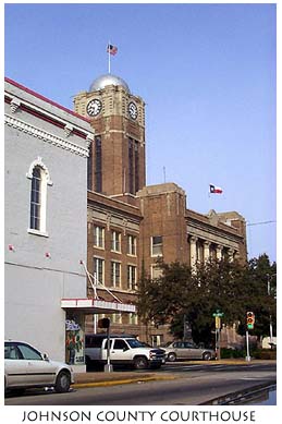
Cleburne |
|
|
|
Cross |
|
|
|
Godley |
|
|
|
Grandview |
|
|
|
Joshua |
|
|
|
Keene |
|
|
|
Rio Vista |
|
|
|
Venus |
|
|
|
|
||
|
|
|
|
|
Alvarado ISD |
|
|
|
Burleson ISD |
|
|
|
Cleburne ISD |
|
|
|
Godley ISD |
|
|
|
Grandview ISD |
|
|
|
Joshua ISD |
|
|
|
Keene ISD |
|
|
|
Rio Vista ISD |
|
|
|
Venus ISD |
|
|
|
GEOGRAPHY |
||
|
Land area (1999) |
729 |
sq. mi. |
|
Region of the country (1999) |
Southwest |
|
|
Average temperature (1999) |
65.4 |
° |
|
Average high temperature (1999) |
76.0 |
° |
|
Average low temperature (1999) |
55.0 |
° |
|
Annual rain (1999) |
34.0 |
inches |
|
Annual snowfall (1999) |
3.0 |
inches |
|
Avg. heating degree days per year (1999) |
2,407 |
days |
|
Avg. cooling degree days per year (1999) |
2,603 |
days |
|
Avg. clear days per year (1999) |
136 |
days |
|
Earthquake index (1999) |
0.0 |
|
![]()
Johnson
County
Alvarado
Burleson
Cleburne
JOHNSON COUNTY ECONOMIC DEVELOPMENT COMMISSION
10 N. Caddo PMB 215, Cleburne, Texas 76031
Phone: 817-556-6985 - Fax: 817-556-6160 - E-mail: jcedc@digitex.net